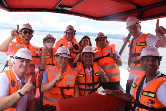
MARIVELES, Bataan — Officials of the Department of Public Works and Highways and Bataan on Friday inspected the site of the Bataan–Cavite Interlink Bridge and the surveyor vessel that manages the hole-boring here.
Onboard deepwater vessel Trinity Surveyor, DPWH Senior Undersecretary Emil Sadain, roads management cluster II project director Sharif Madsmo Hasim, project manager Teresita Bauzon, Bataan Gov. Jose Enrique Garcia III, 3rd District Bataan Rep. Maria Angela Garcia, and Mariveles Mayor AJ Concepcion personally witnessed the actual operations of geotechnical investigation survey on the waters of Bataan.
With the expertise in services requiring hydrographic surveying, Trinity Surveyor has the marine equipment and variety of methods and technical means for carrying out exploratory work to study diverse natural conditions for gathering good quality information.
The governor said they were informed that the vessel on Thursday reached the target depth of 125 meters borehole for the South Channel Bridge area. Other research vessels have been deployed to carry out geophysical surveys.
DPWH, Garcia said, is eyeing the completion of the detailed engineering design of the 32-kilometer-long interisland bridge project that will link Cavite and Bataan via Manila Bay by the first quarter of 2023.
The governor said Sadain reported that marine geophysical surveys and geotechnical investigations in evaluating underground conditions and site characterization over the waters of Manila Bay are ongoing with an overall accomplishment of 55%.
The project will be completed in five and a half years. With the four-lane bridge, travel time from Bataan to Cavite will be cut from five hours to 20 to 30 minutes, Garcia said.
DPWH said the Bataan-Cavite Interlink Bridge project includes the construction of two cable-stayed navigation bridges on either side of Corregidor Island. Called the North Channel Bridge and South Channel Bridge, the structures will have main spans of 400 meters and 900 meters, respectively.


